Ongoing support for Kingston as lake levels start to recede
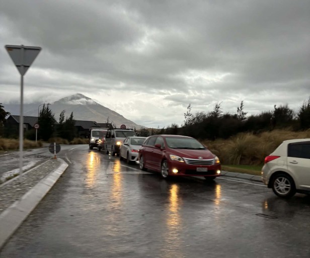
The clean-up is underway and Queenstown Lakes District remains open for business ahead of Labour Weekend. Efforts are now focused on supporting the community of Kingston and reopening any remaining roads still closed because of flood damage or fallen trees.
Kingston, located at the southern end of Lake Whakatipu, is currently without power and has limited cellphone coverage. While neither service is managed by Queenstown Lakes District Council (QLDC), staff from QLDC and Emergency Management Otago (EMO) are liaising closely with the township’s Community Resilience Group (CRG) to offer both practical support and reassurance to residents.
A district-wide Emergency Operations Centre (EOC) was set up by QLDC and EMO yesterday to respond to rising lake levels and other issues caused by heavy rain and strong winds.
EOC Controller Bill Nicoll said the lack of power was having a greater effect on Kingston residents than it would elsewhere in the district given the township’s reliance on the Powernet electricity network.
“Household water supply is pumped from bores, so we’re working closely with the CRG to make sure Kingston residents have access to clean water, temporary power from generators, and portaloos,” he said.
“We recognise that Kingston’s main electricity provider PowerNet is, in its own words, ‘overwhelmed’ with outages across their network and are asking that customers only call if there are downed lines or trees across lines.”
“We’ll continue to do all we can to support residents in our district’s southernmost township until mains power and cellphone coverage is restored,” said Mr Nicoll.
Queenstown Lakes District Mayor-Elect John Glover visited Kingston this morning to talk with residents and see conditions for himself.
Speaking about the last 24 hours he said: “I'd like to recognise and thank all the Community Resilience Groups for their care locally, the multi-agency team that came together to run the EOC, and the unseen 'boffins' from agencies such as Otago Regional Council and NIWA who have really helped us understand and track this flood event.”
“I recognise the impact in terms of staff time and anxiety that all of this is having on our local businesses, and I hope you are all able to make the most of this holiday weekend.
Lake levels in Whakatipu and the Upper Clutha peaked in the early hours of this morning (Friday) and are expected to continue to recede despite lesser amounts of rain in the forecast for the next few days. Lake levels are monitored by Otago Regional Council with information available on its website: https://envdata.orc.govt.nz/AQWebPortal/Data/Map/Parameter/Lake%20Level/Interval/Latest
Sandbags provided by QLDC and its contractors that several Queenstown lakefront businesses installed as a precaution are now being removed, and clean-up of large amounts of driftwood washed up onto the foreshore in Queenstown, Wānaka, Glenorchy and elsewhere by strong winds is underway.
The Queenstown Lakes District Harbourmaster is urging boaties to use extreme caution over the long weekend because of the significant amount of debris in our lakes. This includes large logs and trees washed down from flooded rivers, much of which floats just below the surface and can be difficult to spot. Standard practice regarding lifejackets, flares, VHF radios and mobile phones all in good working order applies as normal.
The following roads remain closed:
- SH6 (Haast Pass) between Makarora and Haast (managed by NZTA).
- Mount Aspiring Road after the Treble Cone turn-off – there is currently no access to Mount Aspiring National Park; this road will potentially remain closed until next week.
- Rees Valley Road north of Glenorchy.
- Paradise Road north of Glenorchy; this road will potentially remain closed until next week.
- Skippers Road.
Further updates will be available on QLDC’s website and Facebook page @QLDCinfo.