Futureproofing Lake Whakatipu water level monitoring
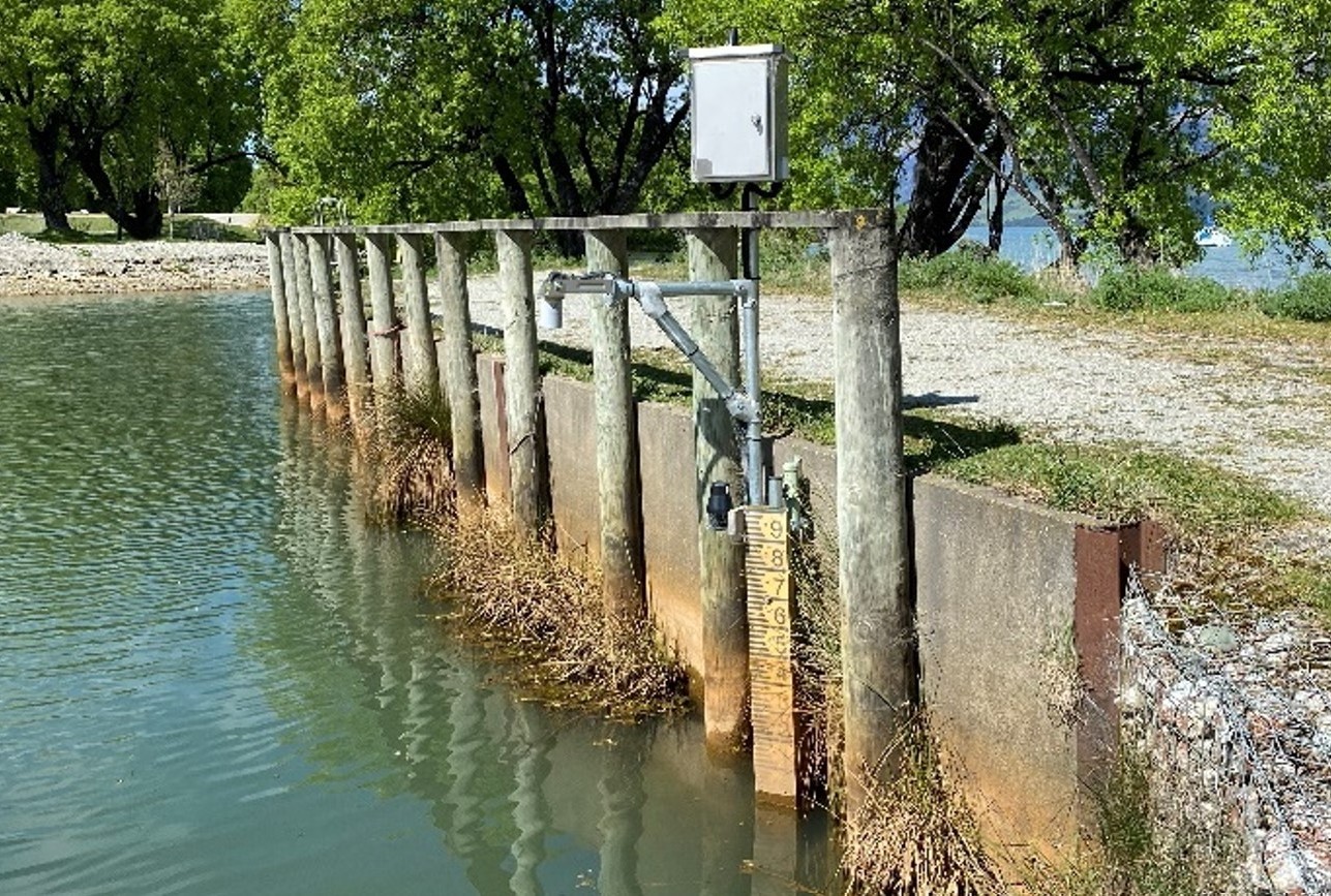
An upgrade of monitoring equipment at the Glenorchy boat ramp this week will improve the reliability of the information the Otago Regional Council collects about Lake Whakatipu level changes.
During 14-15 January, the existing solar-powered water level recorder will be upgraded and raised an extra 2.1 metres, which will ensure it can keep monitoring during very high lake levels.
ORC’s Manager Natural Hazards Jean-Luc Payan says the boat ramp recorder was installed three years ago as a trial to complement the Glenorchy Lagoon water level recorder installed in December 2020 and the Rees River flow recorder installed in December 2021.
“The data’s been so valuable that we’re futureproofing this monitoring site and making it a permanent part of the monitoring network.”
The near real-time information ORC receives from its recorders enhances our monitoring and response during heavy rainfall events and provides a longer-term dataset of baseline information we can use to analyse flooding hazards, he says.
Data from environmental monitoring (e.g. rainfall, river flow and lake levels) is used to alert Emergency Management Otago of potential flooding to assist with a response.
It also complements ORC’s other flood response tools, such as flood forecasting models which can be used to forecast water levels for Lake Whakatipu and the Glenorchy Lagoon.
he lake level recorder will be mounted approximately 2.6m above ground level (measured from the top of the concrete retaining wall at the boat ramp), compared to the 0.5 metre height of the current recorder.
ORC’s Manager Environmental Monitoring Eve Bruhns says the recorder utilises a solar powered battery.
“We’ve designed it to cope with the modelled water level the lake might experience during a 200-year flood event.”
The recorder’s sensor is an up-down encoder which sits within a stilling well, which means it floats on the water surface inside a steel tube.
“The position of the water surface is measured using a float and counterweight system, so as the water level changes, the float position changes. This is linked to a wheel that can very accurately measure the water level change to a 1mm resolution.
“Near real-time data from the Glenorchy boat ramp water level recorder and data on a number of other environmental parameters can be viewed on ORC’s Environmental Data Portal.”


