Clues left by the Alpine Fault’s last big quake reveal its direction – this will help NZ prepare for the inevitable next rupture
Jesse Kearse, Postdoctoral Researcher in Seismology, Kyoto University, and Nicolas Barth, Assistant Professor of Geology, University of California, Riverside, writing for The Conversation NZ.
One of the world’s most anticipated earthquakes is the next major surface rupture of the Alpine Fault in the South Island of New Zealand.
With a 75% chance of it happening within the next 50 years, there is justified interest in the likely magnitude, extent and intensity of ground shaking and impacts on the landscape, infrastructure and buildings.
A key – and so far unanswered – question is which direction the fault rupture will take.
Our new research reveals for the first time that the Alpine Fault ruptured from south to north in the great magnitude 8+ earthquake of 1717.
We developed our technique to determine rupture direction based on the Kekerengu Fault after the 2016 Kaikōura earthquake. But our method is globally applicable for use in realistic earthquake scenarios and thus can contribute to better societal preparedness.
In an Alpine Fault earthquake, there’s no direction that’s good news for the West Coast of the South Island. But a north-to-south rupture would send excess seismic energy into the relatively unpopulated region of Fiordland and the Tasman Sea.
A south-to-north rupture on the other hand is forecast to cause higher intensity shaking in the populated regions of Canterbury, Marlborough, Tasman and the northern West Coast.
In the Kaikōura earthquake, Wellingtonians experienced this influence of rupture direction on shaking intensity. The south-to-north rupture meant more seismic energy was focused towards the capital city than, for example, Christchurch.
So, while rupture direction has been observed to make a big difference in modern earthquakes, it is not something geologists have been able to directly determine for past earthquakes.
Markings in the rock face
The Kaikōura earthquake was well documented by seismographs. We know it started near Waiau in the south and travelled northwards to Cook Strait over a period of two minutes.
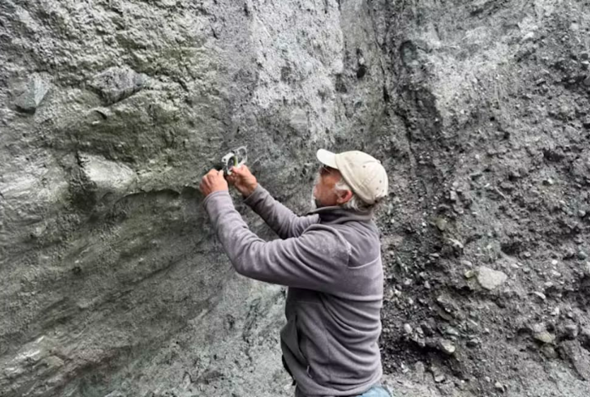
We observed markings that were scratched onto the fault plane. Like coarse sandpaper against wood, these scratches, or “slickenlines”, record movement as rock faces slipped past each other during the earthquake. Some of these markings were curved, and our method can tell us the direction the earthquake rupture was travelling.
Using computer models to simulate how the earthquake unfolded moment by moment, we were able to replicate the curved slickenlines observed in the field and relate them to rupture direction. This gave us the framework we needed to investigate rupture direction for past earthquakes on the Alpine Fault.
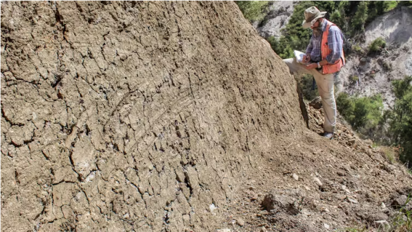
The Alpine Fault hasn’t had a major surface rupture since 1717. During field work, we visited three sites along the fault and examined natural outcrops, carefully exposing the fault plane using hand tools. We found 146 slickenlines, 30 of which were curved.
Slickenlines from the Kekerengu Fault, taken days after the 2016 Kaikōura earthquake. Kate Clark, CC BY-SA
The curved geometry of slickenlines from the Alpine Fault’s most recent earthquake indicated it had travelled from the south towards the north. We also found evidence for rupturing in the opposite direction, suggesting that earthquakes can start both north and south.
On one outcrop, we found evidence of slickenlines from multiple earthquakes – a rare and tantalising find suggesting development of a longer history of rupture direction may be possible.
The technique we’ve applied is a novel, on-fault observational method for determining past rupture directions. Its full potential is yet to be tested, but already it’s applicable to faults worldwide.
Our research shows that the last Alpine Fault rupture was from the south, and that both directions are possible. New information about past earthquakes like this helps the scientific community produce realistic scenarios for the next major earthquake.
We now have direct evidence from the fault itself that we need to prepare for the scenario of very strong to severe shaking for the northern West Coast, Tasman, Marlborough and Canterbury regions in the next major Alpine Fault earthquake.
![]()