Chilly Good Friday forecast as southerly winds sweep NZ
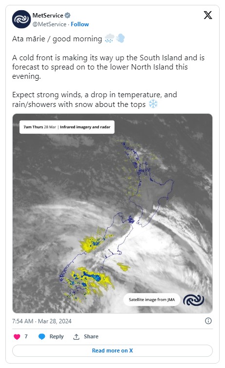
Cooler temperatures are forecast nationwide as unsettled weather from the southwest hits the country this Easter weekend.
Blustery conditions were on the cards for many in the North Island, with a slow-moving area of low pressure forming off East Cape likely to bring a wet weekend to Tairāwhiti and Hawke's Bay, particularly on Saturday, MetService said.
And while the South Island would see plenty of fine, dry weather, it would not escape the cool change.
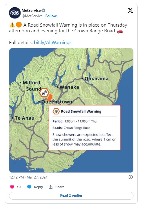
Good Friday would be particularly nippy, the forecaster said, with snow showers expected to affect the summit of Otago's Crown Range Road from Thursday afternoon until early Friday morning.
Highs of just 13C for Christchurch and 14C for Wellington are forecast for Friday, with overnight temperatures in parts of Auckland predicted to drop to 9C.
MetService meteorologist John Law told Morning Report those living in northern and eastern parts of the North Island should expect some wet weather, however there could be a silver lining.
"At the moment it is looking like the worst of the weather [is] hopefully staying offshore."
It would definitely be "a cool start to the Easter break", he said, with overnight temperatures expected to drop quite widely across the country overnight on Friday.
However the worst of the wind in the North Island was set to ease off as the weekend progressed, and higher pressure across the South Island should also keep things there "generally dry and clear".
"I think everyone should get some brightness and a bit of sunshine at some point this Easter."
'A nice dusting'
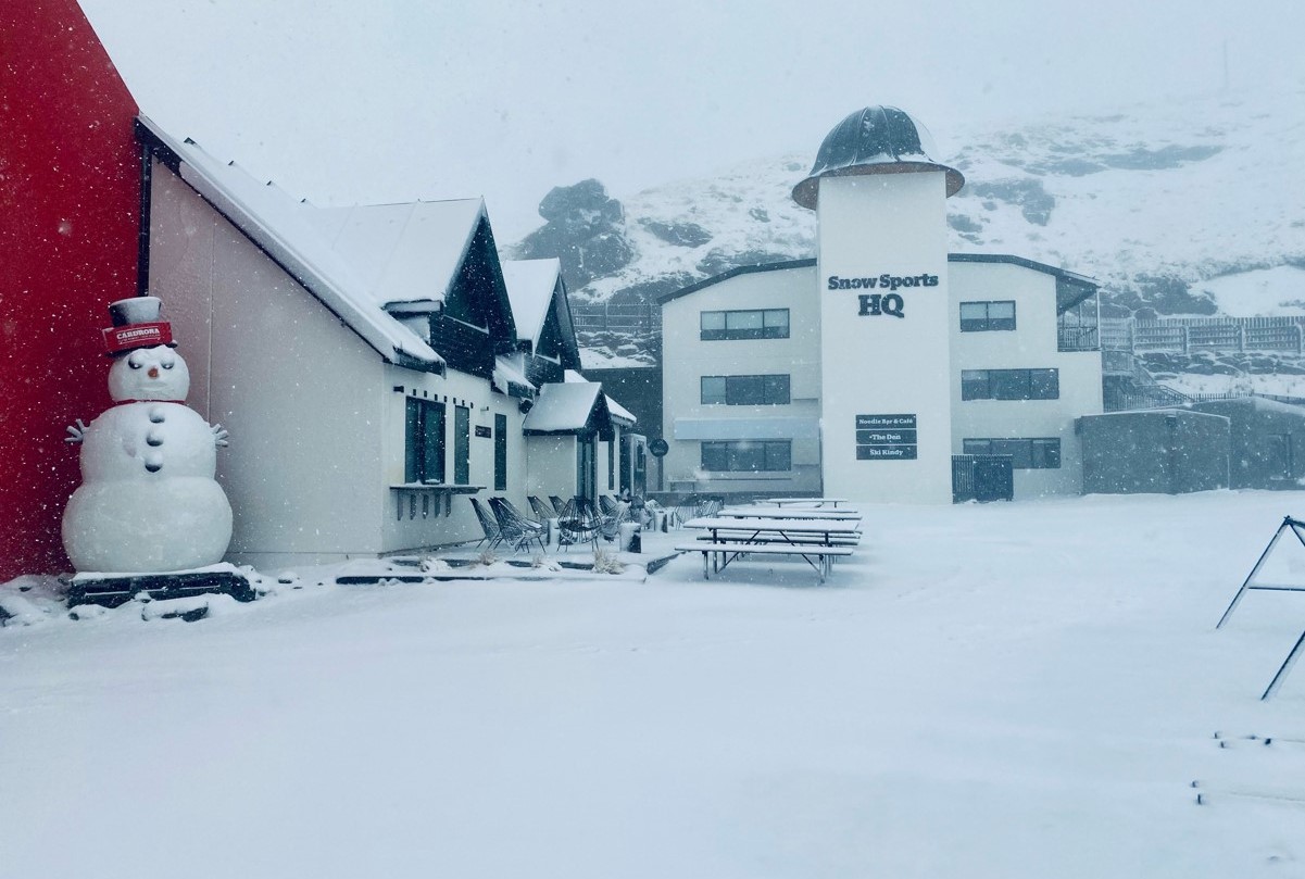
The first snow of the year has fallen at Otago's Cardrona ski field and more is expected as the cooler temperatures settle in.
Cardrona and Treble Cone Experiences general manager Laura Hedley spoke told Morning Report the snow had arrived a little earlier than usual and it was "pretty cold up the hill".
"We got a couple of centimetres yesterday; I think we're going to get a little bit more today."
With wind-chill taken into account, temperatures at the ski field had dropped to just below freezing on Wednesday, Hedley said.
"It's a nice dusting and a bit chilly down in Wānaka."
There was still a lot of work to do before the ski season started but Hedley was hopeful the early snow was a sign of a cold and snowy winter to come.
"I know people will be looking up there eager for the winter ahead."
![]()